STAY ALERT
Millions pinged with emergency alert TONIGHT as rare ‘danger to life’ warning issued with ‘severe’ tornado threat
4.5 million people could be alerted by sirens ahead of the red alert

MILLIONS of Brits have received an emergency alert on their phones after a rare RED "danger-to-life" weather warning was issued.
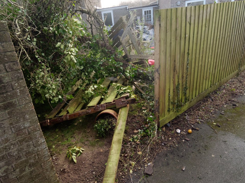
Violent Storm Eowyn is set to lash Britain with wild 100mph winds sending debris flying, ripping off roofs and severely damaging buildings.

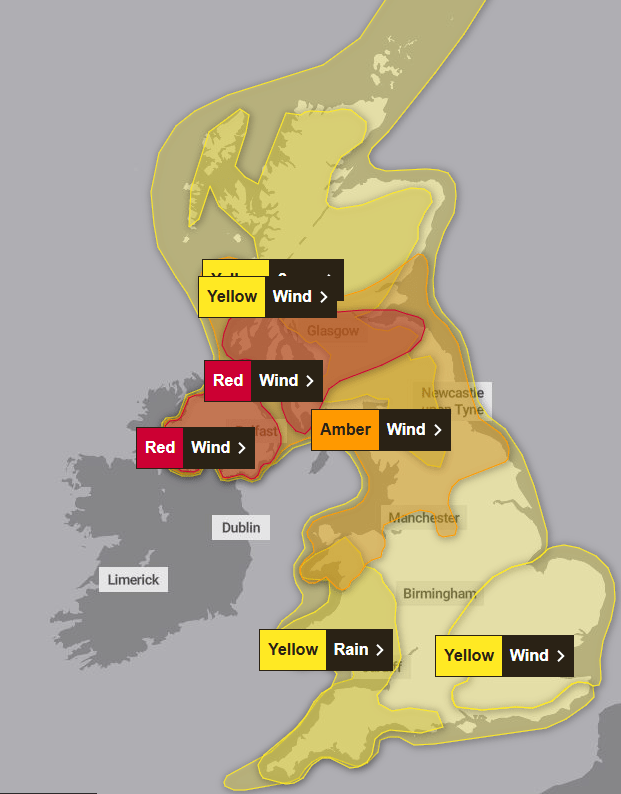
The shocking warning pinged directly to the phones of the 4.5 million people affected across Northern Ireland and parts of Scotland.
The alert was issued to urgently raise caution ahead of the 100mph winds in specific areas.
A siren was heard by those who had set their devices to silent.
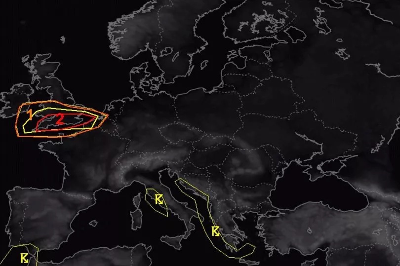
It comes amidst residents in Cornwall having to brace for a tornado which left a tail of destruction, tearing roof tiles from homes.
The severe winds battered exposed costal areas with at least one person injured.
Further tornados are expected across the country with the train operator, Scotrail, already cancelling its entire network for Friday.
With thousands of services already suspended, the Met Office currently predicts its red warning to remain in place from 10am to 5pm on Friday with dangerous conditions to driving and all travel expected.
Meteorologists have warned that tornados "cannot be ruled out" in southern England as well.
The weather experts have warned how "very dangerous conditions" could cause power cuts, material being thrown onto coastal roads, flying debris and roofs blown off.
Current advice includes to stay indoors as being outside in the gails could make residents "vulnerable to injury".
The Met Office has also described the warning has having a "high likelihood" and "high impact".
A Cabinet Office spokesperson said: "The Met Office has issued a red warning for wind on Friday January 24, meaning there is a danger to life across Northern Ireland and parts of Scotland.
"In light of the deteriorating weather conditions and associated disruption, and in consultation with the Scottish Government and Northern Ireland Executive, the Cabinet Office will issue emergency alerts early this evening to people affected by the warnings in Northern Ireland and parts of Scotland.
"The emergency alert system will send a message to every compatible mobile phone in the areas at most risk, containing information about the weather warnings and guidance on how to stay safe."
The Met Office has issued the red alert ahead of the severe weather expected tomorrow.
It has predicted the following regions and local areas will be affected:
Central, Tayside and Fife
SW Scotland, Lothian Borders
Strathclyde